


SWOT Satellite Captures Tsunami Wave After Kamchatka Quake
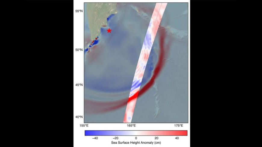
On July 30, 2025, the NASA–CNES SWOT satellite captured the leading edge of a tsunami wave in the Pacific, triggered by an 8.8 magnitude earthquake near Russia’s Kamchatka Peninsula. Recorded about 70 minutes after the quake, the wave measured 1.5 feet in open water but could grow to 30 feet at shore. SWOT’s advanced radar mapped the wave’s height, profile, and direction—providing data never before captured in such detail. NOAA’s Center for Tsunami Research found that integrating SWOT data could greatly improve forecast accuracy, a major step forward in disaster preparedness. Experts see this as a breakthrough in early tsunami detection.